Captured with Realsee Galois P4 LiDAR

Transform every property into an immersive 3D experience

Millimetre-accurate 3D tours, floor plans and CAD for any property in Riyadh. One visit from us, and the space sells itself online — day or night, from anywhere.

Riyadh, same-week slotsFixed price up frontDelivered in 3 days
±10mm
Measurement accuracy
24K
Up to 320MP panoramas
16 sec
Per scan point
3 days
Tour and stills delivered
Who it's for

Same camera. Very different reasons to book it.

What you get

Technolgy Deliverables

We scan once and the platform produces every format from the same data — so the tour a buyer walks and the drawing your contractor works from describe exactly the same building.

01

3D walkthrough

A link that opens in any browser. Walk room to room, switch to dollhouse view, measure a wall without being there.

Shareable link · Website embed
02

Floor plan

Clean schematic layout with room dimensions and areas, drawn from the scan rather than estimated.

PNG · PDF
03

CAD drawings

As-built plans your architect, fit-out contractor or facilities team can open and work in directly.

DWG · DXF
04

Point cloud

The raw registered cloud for BIM coordination, renovation planning and dimensional verification.

E57 · PLY · OBJ · FBX · GLTF
05

24K panoramas

Up to 320-megapixel stills with 8× lossless zoom. Crop a hero shot for a listing without losing a pixel.

JPG · 24K
06

Walkthrough video

A short cut in vertical and landscape, ready to post to Instagram, Snapchat or a WhatsApp broker group.

MP4 · 9:16 & 16:9
Portfolio

Past projects.

Walk through spaces we have captured. Drag to look around, click a floor point to move, or open the tour full screen.

Contemporary Chic · Hittin - 3d walkOpen tour ↗
Hittin, Riyadh · 175 m²

Contemporary Chic Apartment

Open-plan living with a full-length balcony. Captured across two floors, including the terrace and service areas.
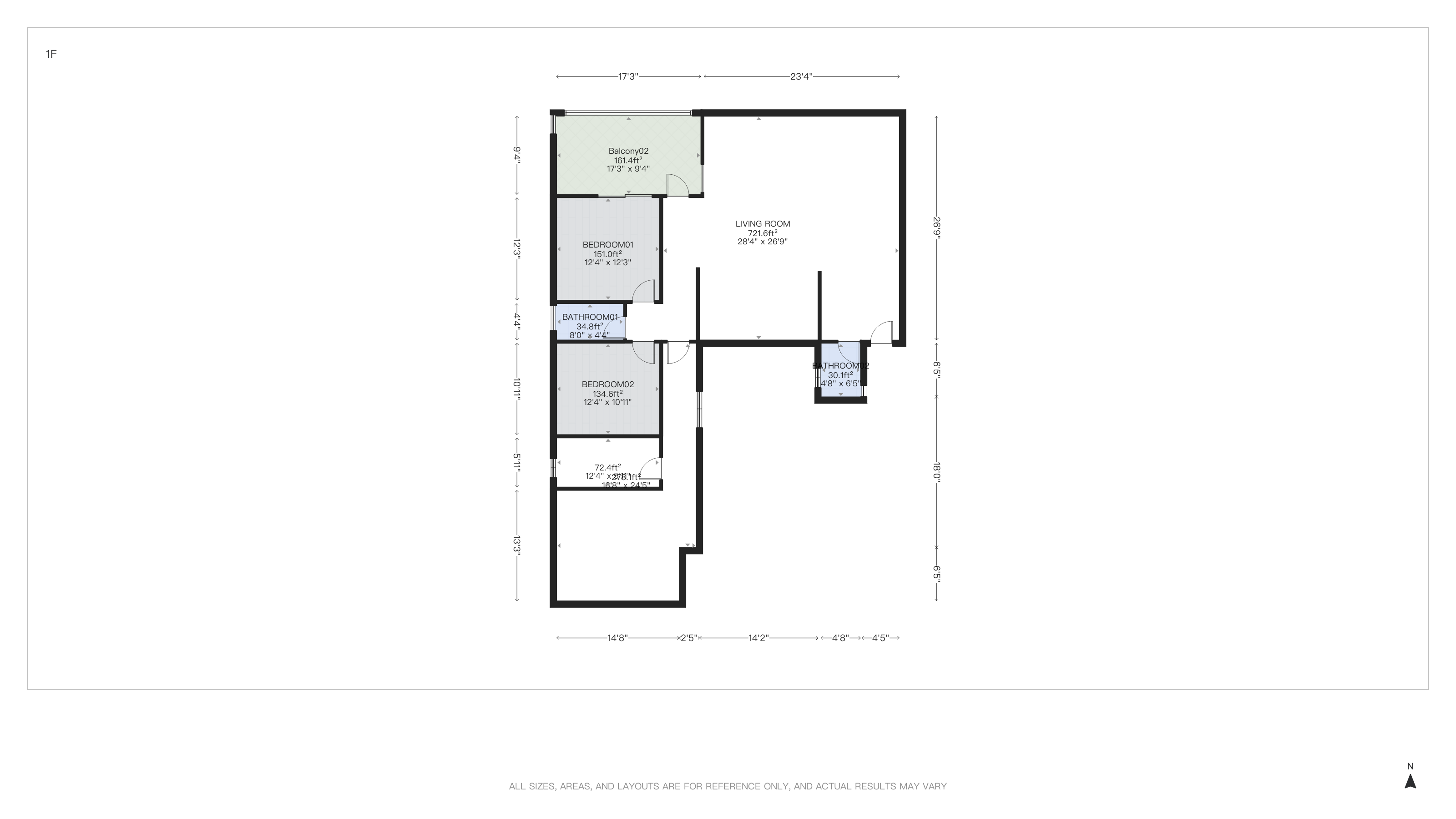
Schematic floor plan of the Contemporary Chic apartment
Schematic floor plan · generated from the scan
Skylight Rooftop · Hittin - 3d walkOpen tour ↗
Hittin, Riyadh · 50 m²

Skylight Rooftop Retreat

Rooftop studio with a private outdoor deck. Interior and exterior scanned in one session so the tour moves straight out onto the roof.
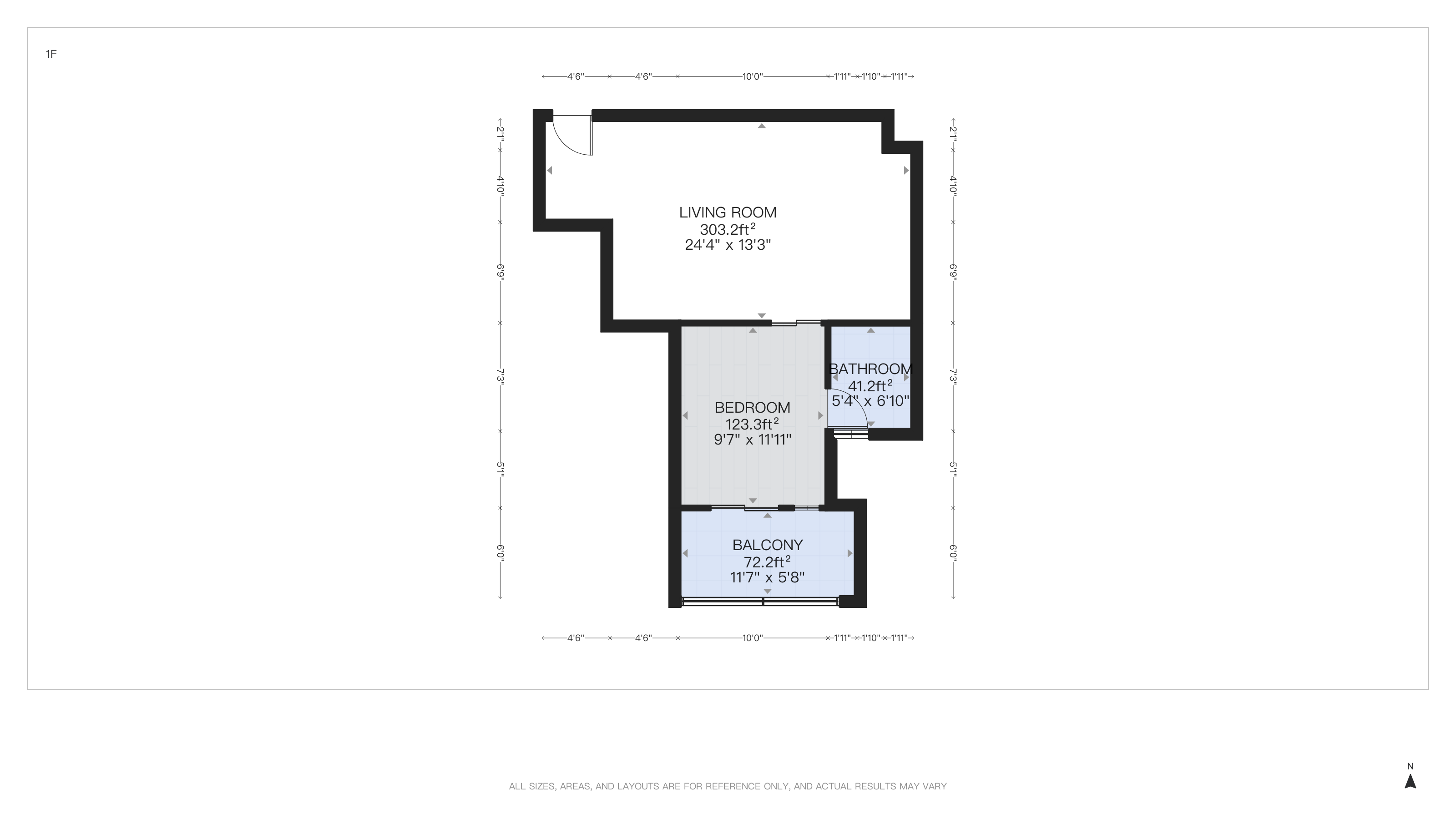
Schematic floor plan of the Skylight Rooftop studio
Schematic floor plan · generated from the scan
On site

Two to three hours in the space. Everything else happens after we leave.

The technology

Realsee Galois P4. Survey-grade, not a phone on a tripod.

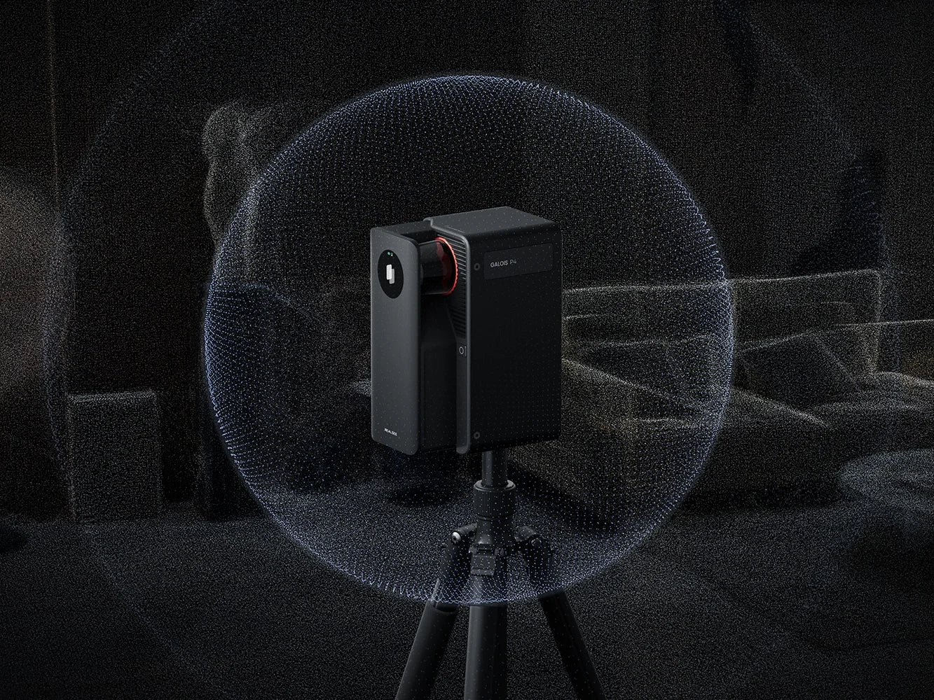
A 905nm LiDAR scanner paired with a 47-megapixel lens on a 4/3-inch sensor, five exposures per HDR frame. It reads a space at 125,600 points per second and reconstructs it automatically — no manual stitching, no guesswork in the geometry.

Realsee Galois P4 scanner surrounded by the point cloud it captures
  • Scanning range0.1 – 100 m
  • Point capture rate125,600 pts / sec
  • Field of view360° × 213.25°
  • Measurement error< ±10 mm @ 0.1–15 m
  • Camera sensor47 MP · 4/3-inch CMOS
  • Panorama output24K · up to 320 MP
  • HDR exposures per frame5-bracket
  • Lossless zoom
  • Capture speed16 sec / scan point
  • Capture efficiency8 min / 1,000 sq ft
  • Blind captureOperator stays out of shot
  • Laser safety classClass 1

Accuracy figures are Realsee's published specifications for the Galois P4, tested in standard interior environments. Luxdar captures with the P4; we are not a Realsee reseller.

DeliverableFormat / OutputBest for
3D virtual toursRealsee tour link / embedProperty marketing, commercial showcases, museums
Point clouds.E57 / .PLYAEC, construction documentation, scan-to-BIM workflows
3D modelsPlatform-supported model outputsVisualization, spatial review, documentation
CAD-ready outputsCAD deliverablesDesign, renovation, construction coordination
Floor plansAuto / manual floor plan outputsReal estate listings, property media packages
RAW imagesRAW image filesPost-production and archival workflows
24K panoramasUp to 300MP panoramic images / JPG downloadMarketing, social media, client reporting
3D snapshotsHigh-quality visual assetsMarketing, social media, client reporting
Pricing

Estimate your price in under a minute.

Capture is priced by property type and size band, with six months of hosting included. Keep the tour live longer and hosting is added by the month; everything else is an optional add-on.

Your estimate
SAR 1,650
Excluding 15% VAT
    Send this on WhatsApp

    An indicative figure based on the property type and size band selected. Models and detailing are priced by area band; casework, furniture and services detailing require a Revit or SketchUp model and reprice against whichever you choose. The final quote is confirmed after we see the layout — it does not change after you book.

    Questions

    Frequently asked questions

    How long does a capture take?

    Around 16 seconds per scan point, so roughly 8 minutes per 1,000 sq ft of floor area. A typical Riyadh apartment is done in two to three hours including setup.

    Do I need to be there?

    No. Someone needs to let us in and the space needs to be clean and lit. We capture without appearing in the shots, so there is no person standing in your tour.

    How accurate are the measurements?

    Under ±10mm error between 0.1 and 15 metres. Accurate enough for fit-out planning and BIM coordination, but not a substitute for a licensed surveyor's certified drawing.

    Can I put the tour on my own website?

    Yes. Every tour comes with embed code that drops into a listing page, and a plain link for WhatsApp, Aqar or Bayut.

    Can the tour carry my branding?

    Yes. Your logo, contact details and company introduction sit inside the tour, so an enquiry from it comes straight to you.

    What happens after the first year?

    Hosting runs at SAR 35 per month and you choose the term up front — 3, 6, 12 or 24 months. Extend it any time. Files already delivered to you — stills, CAD, point cloud — are yours permanently either way.

    How long do Revit and SketchUp models take?

    15 to 19 business days, weekends and public holidays excluded. Every wall, door, window and room is modelled by hand from the point cloud rather than auto-generated, so you get clean geometry and correct layers in a file that opens natively in your own tools. Tell us whether you need architectural or interior-only scope, and imperial or metric units, when you order.

    Do you scan outdoors?

    Yes. The scanner reaches 100 metres, so façades, courtyards, compounds and construction sites are all in range.

    Can you scan while the space is occupied?

    Yes, though the tour looks better empty or properly staged. For hotels and offices we work around your hours.

    Book a capture

    Your next listing
    could sell itself.

    Send us an address. We'll confirm a price and a capture slot the same day.